

3 Maps to explain the Storm Impacting Ontario
- Kyle Brookings

- Dec 5, 2021
- 1 min read

An area of low pressure will push across Ontario beginning this morning in northwestern sections of the province and reaching all areas by this afternoon. Snow, rain, freezing rain, and strong winds are anticipated.
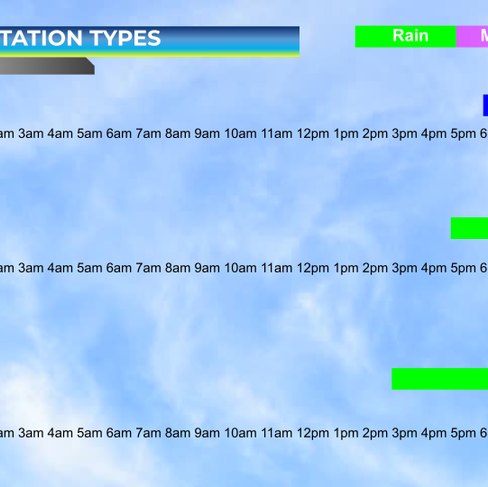
Northern Ontario will see mostly snow with amounts ranging from 15 to 30 centimetres from Thunder Bay east to the Quebec border and as far north as Timmins. Winds gusts to 60 km/h are possible.

Northeastern and Central Ontario, including Ottawa, will see snow to start late his afternoon and there is a risk of freezing rain overnight into Monday morning. Snowfall amounts of 10-15 cm are possible. Rainfall amounts of 10-15 mm are possible, about 2 to 4 mm of that could be freezing rain. Winds will gust to 70 km/h.
Across southern Ontario, precipitation is expected to be mostly rain. Rain will commence by mid to late afternoon. Amounts of 15 to 25 mm can be expected. Winds will gust to 70 km/h.

There is the potential for power outages. Travel will be dangerous, particularly in the northern and central sections of Ontario.
Keep checking back for updates, additionally, Andriod users can download our free app in the Google Play Store.
Also, don't forget to check out our Ontario Facebook page for more information.
(Click to Expand)


Comments