
Weekend Storm Update
- Kyle Brookings

- Mar 13, 2020
- 2 min read
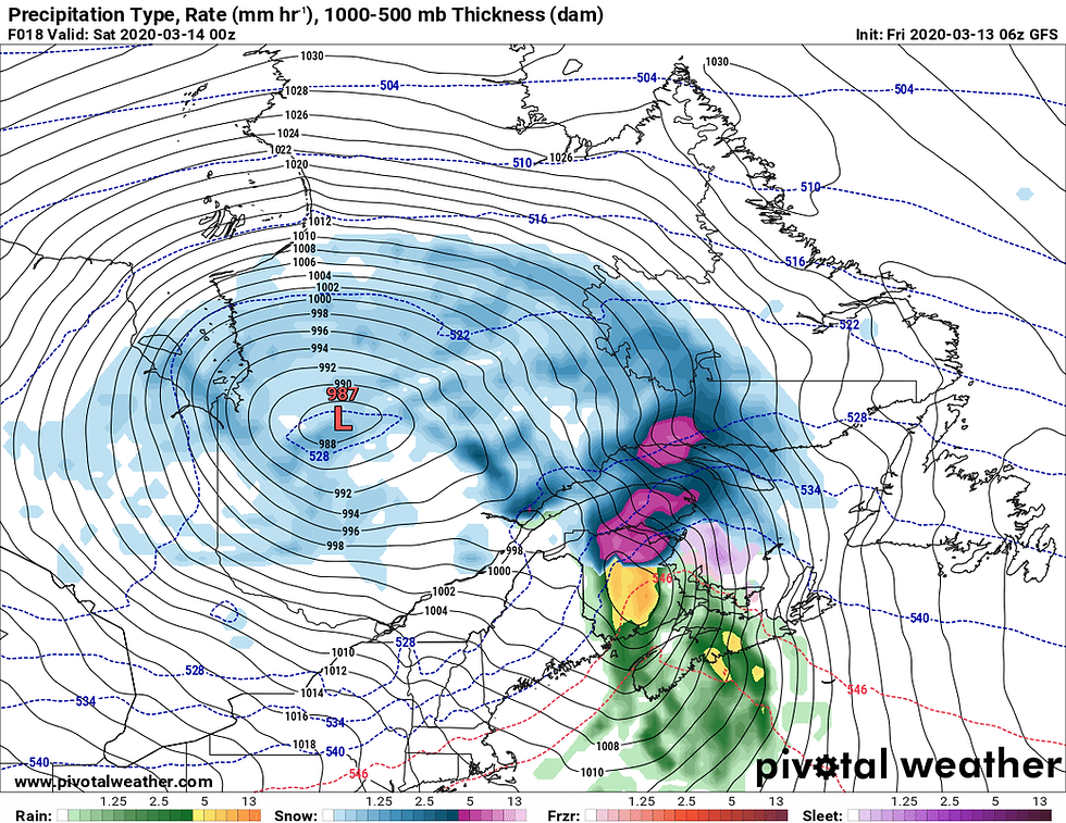
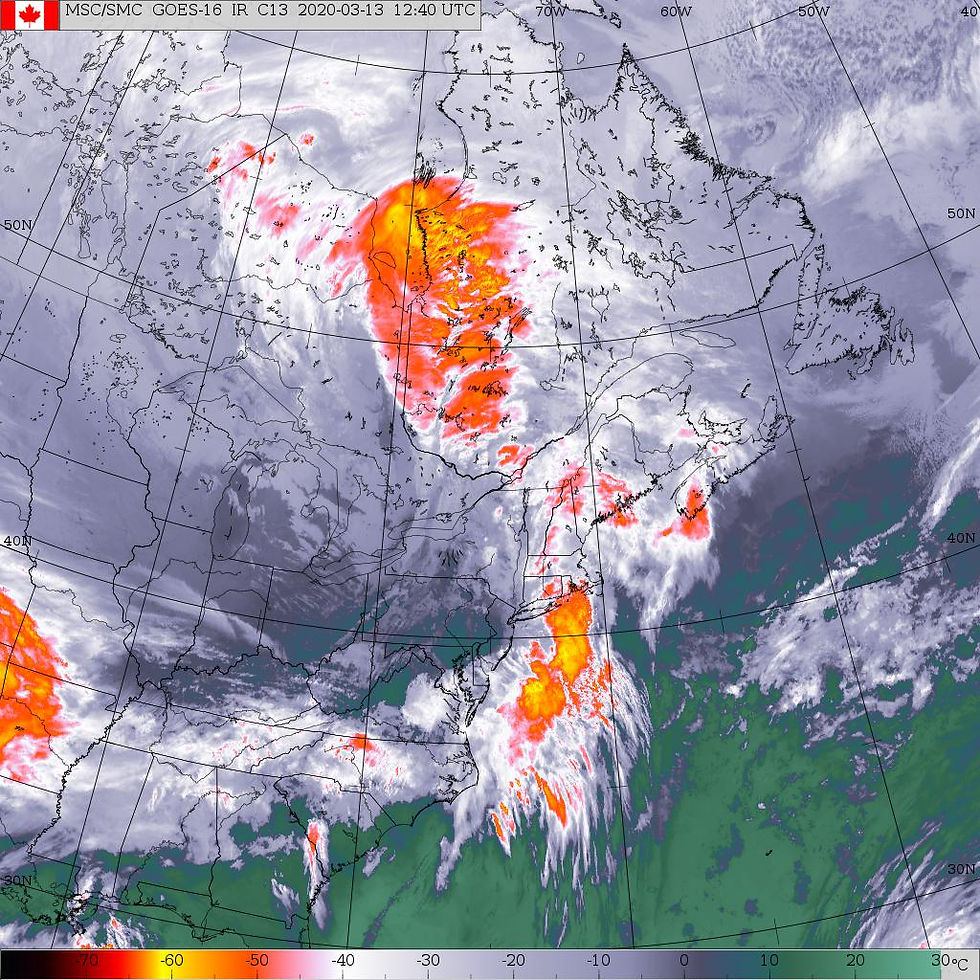
It's the weekend so instead of taking some time to enjoy the last weekend of winter, we are going to get hit with another storm in Atlantic Canada.
New Brunswick
Snow has already arrived in some areas. By this evening the snow will change to rain with a risk of ice pellets. Precipitation ends tonight. In northern sections 15 to 25 cm of snow is possible. 10 to 15 mm of rain is expected in southern New Brunswick.
Prince Edward Island
This evening ice pellets or freezing rain and then rain is expected. Precipitation ends tonight. Only trace amounts of snow are expected. 5 to 10 mm of rain is expected. There will also be strong winds. Restrictions of traffic on the Confederation Bridge will commence approximately 6:00 pm this evening at approximately 2:00 am, March 14, due to strong wind.
Nova Scotia
Rain is expected. It has started in southern sections. The rain will end on Saturday morning. There will be some snow on Cape Breton Island but it will not be significant. Heavy rain is expected for coastal Nova Scotia, up to 40 mm is possible. There will also be strong winds.
Newfoundland & Labrador
Snow moves on to the west coast of Newfoundland tonight and will spread to central Newfoundland. The snow will change to ice pellets or freezing rain and then rain. Freezing rain and rain are expected on the Avalon and south coast. Heavy snow is possible on the Northern Peninsula and west coast where 20 to 30 centimetres could accumulate, much lesser amounts are expected elsewhere. 10 to 15 mm of rain is expected along the south coast. There will also be strong winds.
Marine Atlantic departures have been impacted.
Comments